What is the CartoPac platform?
The CartoPac platform sets the standard for digital pipeline asset management, traceability, and data validation. It enables operators to collect the data necessary to safely manage all pipeline assets within the right-of-way. Providing the most accurate, complete field data, CartoPac supports digital transformation objectives for integrity management and regulatory requirements.
Leverage industry consensus and high value workflows with the CartoPac Platform.
CartoPac’s purpose-built solutions represent best practices for regulatory compliance, reporting and optimized field productivity. Configurable solutions include gas distribution as-built, regulated steel pipeline as-built, leak detection & repair, and inspection, repair and maintenance.
The most complete, most accurate data that we’ve ever received back from a mobile application.
—CartoPac User
CartoPac Mobile
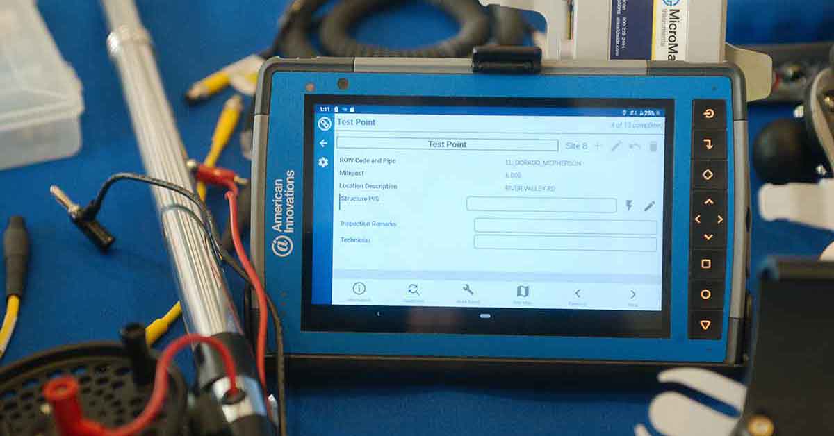
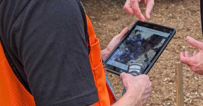
CartoPac Mobile is the primary tool for field data collection. It operates seamlessly on various Windows and iOS devices, including tablets, iPads, and iPhones with sub-meter to sub-decimeter spatial accuracy.
- GNSS receivers from manufacturers including Trimble, Eos, and Juniper with real-time or post-processing differential correction.
- Laser Tech laser range finders capture asset information in difficult-to-reach locations.
- Code barcode scanners capture ASTM F2897 plastic pipe manufacturer data.
- Survey poles, mounting brackets, and cables from a variety of manufacturers complete the CartoPac mobile hardware configuration.
CartoPac Server
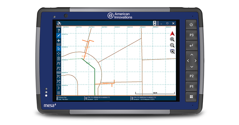
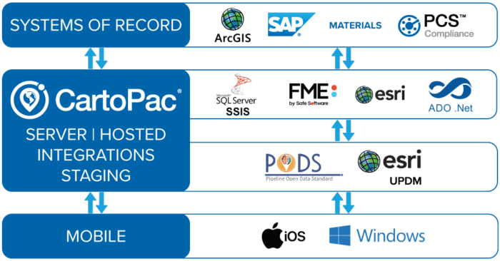
CartoPac Server is your centralized solution for real-time visualization of field-collected data, seamlessly connecting field and back-office operations.
- Works with CartoPac Mobile to efficiently upload and download field collected data.
- Granular user permission management supports tailored access control based on user roles.
- Active Directory and Single Sign-On (SSO) integrations streamlines user authentication.
- Tightly integrated with ESRI’s ArcGIS Server for accurate GIS data visualization.
- Comes standard with KPI report and Field Session dashboards to manage work progress.
CartoPac Workflow Manager (QA QC)
CartoPac Workflow Manager (CWM) is a web-based quality control system that ensures the highest quality field-collected data prior to integration into GIS and other systems of record. It plays a crucial role within the CartoPac platform, adding a layer of review and approval to facilitate validation processes and seamless data integration.
- Ensures that only approved field-collected data goes into your GIS and other systems of record.
- Enforces a consistent review process that includes users from all parts of your business.
- Provides granular control over permissions, allowing administrators to manage access for viewing and editing collected data.
- Maintains a complete audit trail of data modifications for comprehensive record-keeping and accountability.
- Offers built-in integrations for seamless data loading into a wide array of systems of record without extensive development efforts.
- Supports automatic creation of custom reports, including detailed maps of collected assets, through integration with report servers.
- Facilitates customized actions during data transition, such as interfaces to external systems and timers, through plug-in modules, enhancing system functionality and adaptability.
CartoPac Studio—Intelligent Forms
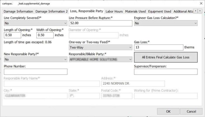
CartoPac Studio is a proprietary intelligent form configuration tool that empowers the CartoPac team to create complex workflows customized to requirements without the need for software development.
This tool revolutionizes the creation of intricate workflows, facilitating rapid development of comprehensive field data collection solutions and real-time modifications to accommodate evolving needs.
- Supports advanced logic and workflow processes that leverage Esri domains, subtypes, work order data sources, and material management data.
- Generates forms for iOS and Windows tablet devices.
- Enables application administrators to modify CartoPac forms without specialized code.
- Supports a wide range of data connectivity, including Esri feature services and ADO connections for Oracle and SQL Spatial support.
- Complex symbology rules ensure that your field data collection maps are consistent with other GIS systems.
CartoPac Studio ensures the most traceable, verifiable, and complete field data, using metadata fields that collect “data about your data” without user input. These fields include:
- The date, time and user who collected the data
- A wide array of detail from the ASTM asset barcodes
- Dozens of attributes about the quality of the GNSS signal at the time of collection
Over 60 metadata properties provide a rich audit trail of your field collected data
CartoPac Hosted
CartoPac Hosted is a Microsoft Azure-hosted environment we use to deploy CartoPac Server. It offers a comprehensive solution to manage hardware, IT infrastructure, data, and user security.
- SOC-2 compliance meets or exceeds corporate data security requirements and minimizes the impact on internal IT resources.
- Supports key integrations with work order management and third-party Operator Qualification systems to enhance workflow efficiency.
- Dedicated hosting—CartoPac servers are for individual clients and not shared.
- Single Sign-On (SSO) and Multifactor Authentication (MFA) options are available.
CartoPac Platform Pre-Configured Workflows

Gas Distribution As-Built
Capture all the data required to meet pending PHMSA tracking and traceability requirements for your gas distribution pipelines.

Regulated Pipelines—Steel As-Built
Create a highly accurate and complete digital twin of your pipeline and the necessary components for a complete as-built package.

Leak Detection & Repair
Effectively and efficiently manage leak detection and damage assessment in gas distribution systems.
RELATED products
Your Trusted Data Partner
We support you every step of the way to ensure your data is traceable, verifiable, and complete.
Integrations deliver your data where it needs to go, including enterprise systems of record such as GIS, Maximo, and SAP.


